About
Bradanforda be Afne
Virtual model
Bradanforda be Afne is a virtual model of Bradford on avon in 1011. A few years after the completion of the 1000 year old Saxon church.
Method
I used the 1 metre resolution LIDAR scan of Bradford, plotted the location of all the relevant archeology and then manually removed the buildings. The slopes of Bradford have been largely terraced so they can be built on, so I then restored the natural topography to something that looked credibly eroded by wind and water.
East West route
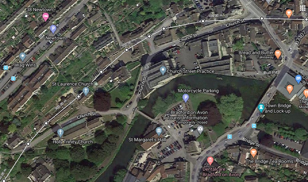
In the iron age, the river is thought to have been a frontier. So I flooded the river and plotted a route so it could be patrolled east to west at any point near the river, on the most gentle slopes, just comfortably above both the maximum recorded flood level, and the maximum flood level I could create, that used up all of the flood plain. I've illustrated the resulting route here on a Google map below.
Bradanforda be Afne is a virtual model of Bradford on avon in 1011. A few years after the completion of the 1000 year old Saxon church.
Method
I used the 1 metre resolution LIDAR scan of Bradford, plotted the location of all the relevant archeology and then manually removed the buildings. The slopes of Bradford have been largely terraced so they can be built on, so I then restored the natural topography to something that looked credibly eroded by wind and water.
East West route
In the iron age, the river is thought to have been a frontier. So I flooded the river and plotted a route so it could be patrolled east to west at any point near the river, on the most gentle slopes, just comfortably above both the maximum recorded flood level, and the maximum flood level I could create, that used up all of the flood plain. I've illustrated the resulting route here on a Google map below.
Spontaneously emerged
I then included the mundane but vital open drainage needed to support all the assets like the Saxon church, the excavated wooden house, the Anglo Saxon port and ford etc. In doing so, the historical street plan spontaneously emerged as the obvious routes to navigate anywhere from a to b. This then determined many of the land plot boundaries.
I then included the mundane but vital open drainage needed to support all the assets like the Saxon church, the excavated wooden house, the Anglo Saxon port and ford etc. In doing so, the historical street plan spontaneously emerged as the obvious routes to navigate anywhere from a to b. This then determined many of the land plot boundaries.
Anglo Saxon Bradford looked much like the Saxon church, but in wood.
Below is a shot of the inside of the Saxon church looking towards the alter. If you look at the the course of stone at the base of he walls (You could describe it as the stone skirting board :) in this picture. You’ll notice it’s not level, but follows the slope of the underlying terrain.
Below is a shot of the inside of the Saxon church looking towards the alter. If you look at the the course of stone at the base of he walls (You could describe it as the stone skirting board :) in this picture. You’ll notice it’s not level, but follows the slope of the underlying terrain.
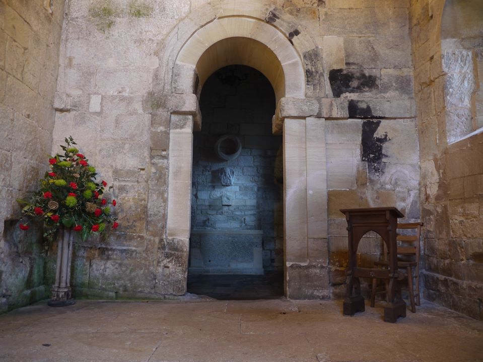
Why didn’t they do what we would do and build a level building on a level plinth?
Well, the Saxon church is a stone building trying to look like a timber building with posts and rails. it's showing us how those old timber buildings were constructed, and that it was normal, acceptable common practice, to not even level the hillside, but do the best you can at levelling and then let the floor plate rest on the slope of the hill. You then build a level floor inside.
Well, the Saxon church is a stone building trying to look like a timber building with posts and rails. it's showing us how those old timber buildings were constructed, and that it was normal, acceptable common practice, to not even level the hillside, but do the best you can at levelling and then let the floor plate rest on the slope of the hill. You then build a level floor inside.
So let's go to a construction site to view this slope clinging building technique :)
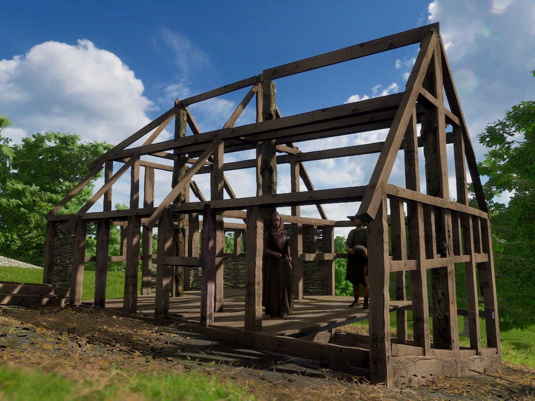
In the picture above you can see a level floor is created using carpentry, rather than moving tons of soil to create a level building plot. Instead, that weight of soil is holding the structure solid, via 3 large whole tree trunk posts wedged into deep stone lined holes. The house frame is then built around these solid secure posts. Thus, the Anglo Saxons largely avoided the effort involved in building, and maintaining, the large retaining walls usually needed to create a level plot on sloping ground.
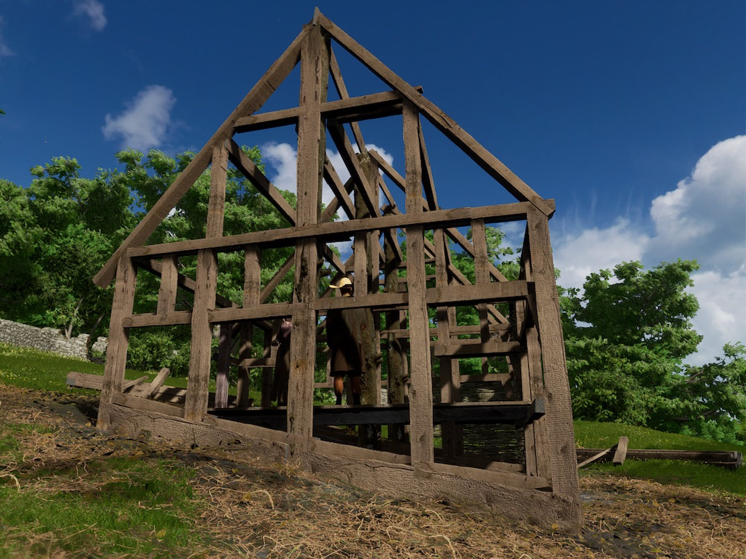
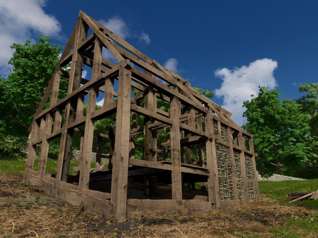
Above you can see some wattle infill, waiting to be covered in daub plaster to create the panels between the timber frame, and also help brace the entire structure.
Calculating the size of Anglo Saxon Bradford
The Doomsday book of 1086 lists Bradford on Avon and Alveston (which I think was at the crossroads of Culver close and the old grammar school) as having 159 households between them. You could intuitively give each household a rough average of six members. 2 grandparents, 2 parents and 2 surviving children out of the six that were born. Giving us a population of 954. Given that between 1011 and 1086, there had been the attrition of 2 invasions and then some modest stability and growth, I think 159 dwellings is a reasonable rough estimate for the size of Bradford on avon in 1011.
The Doomsday book of 1086 lists Bradford on Avon and Alveston (which I think was at the crossroads of Culver close and the old grammar school) as having 159 households between them. You could intuitively give each household a rough average of six members. 2 grandparents, 2 parents and 2 surviving children out of the six that were born. Giving us a population of 954. Given that between 1011 and 1086, there had been the attrition of 2 invasions and then some modest stability and growth, I think 159 dwellings is a reasonable rough estimate for the size of Bradford on avon in 1011.
back to HomePage. |
|
